
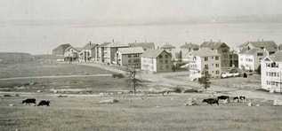
 Durfee Farm
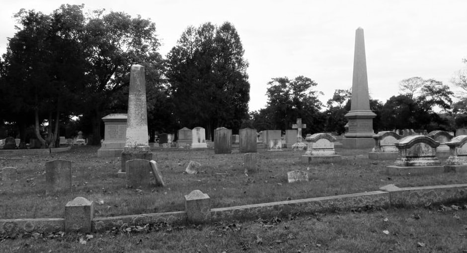
South Park History Renamed Kennedy Park in 1963 after the assassination of President John F. Kennedy
In 1868, the City of Fall River purchased the Durfee/Chace farms for $1,000 an acre. Only six (6) years earlier, before the 1862 settlement of a boundary dispute by the Supreme Court, this land—and everything south of Columbia Street—was part of Fall River, Rhode Island. This new 57-acre parcel would be called "South Park" and would be designed by landscape architect Frederick Law Olmsted and Calvert Vaux.
In 1871, work commenced on the upper flat portion of the planned three-section park. The upper section was the only part of the park built to conform to Frederick Law Olmsted’s original plans. Olmsted’s original design and records were lost in the 1886 City Hall fire. This upper section between South Main and Broadway was called “The Green” and was to have no structures. His idea was that this area would be used as a parade ground and accommodate concerts, cricket creases, and baseball fields.
In 1902, the City of Fall River signed a contract with Olmsted's firm for a revised plan to complete the park. The contract was for $1,800 plus expenses and the work was to be executed by a skilled contractor. The work ended up being performed by unskilled labor,.
By 1904, as the revised plan for park completion began to be implemented, As work progressed, boulders were moved and placed in different, “strategic” locations. The city began raising plants for the park in a nursery, and despite the elder Olmsted’s wishes, a pond was added to the middle section in 1904.
 Quequechan River @ Pocasset Street
Watuppa Ponds History
The Watuppa ponds were originally one large body of water, however during the early 1800's the first action toward dividing the pond into separate North and South occurred when stepping stones were laid across what is known as "The Narrows", a area of land that was at the end of each pond. Today, Route 195 is on top of "The Narrows", this construction forever divided the bodies of water, although still connected by a culvert.
South Watuppa Pond
The third-largest naturally occurring body of water in Massachusetts. The pond is fed by three (3) smaller ponds Davol Pond (Westport), and the Sawdy and Stafford Ponds (Tiverton R.I.). The South Watuppa feeds into the Quequechan River, which provided millions of gallons of water to the city, which powered Fall River's cotton factories.
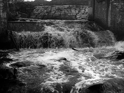
Quequechan River "Falling Water" (Wampanoag)
The Quequechan is a 2-mile long river that flows from the South Watuppa Pond to the Taunton River. The river is calm until it reaches the downtown area where it turns into rapids. The Quequechan originally contained eight (8) small waterfalls. The upper portion of the river was dammed to provide additional water-power and water storage for the mills. During the 1960's I-195 was constructed and a portion of the river was redirected into a series of underground culverts passing under the highway.
North Watuppa Pond
The second-largest naturally occurring body of water in Massachusetts. It has been used as the City of Fall River's primary drinking water supply since 1873, when the Fall River Waterworks was built on its western shore. During the 1840's there were several ice houses located long the shores, those granite walls are still standing today. One particular ice house was constructed in 1864 by Robert Cook and William Durfee. The remains of the ice house sits on a peninsula what was once known as Interlachen, the estate of Spencer Borden, founder of the Fall River Bleachery. Interlachen once contained a large mansion, gardens, horse pastures and a network of bridle paths. The ice houses, owned by Arctic Ice Co., were destroyed by fire in 1933. The Interlachen Estate, its houses, outbuildings and stables, all were demolished after the city’s Water Department acquired the property in 1939.
The Watuppa ponds were originally one large body of water, however during the early 1800's the first action toward dividing the pond into separate North and South occurred when stepping stones were laid across what is known as "The Narrows", a area of land that was at the end of each pond. Today, Route 195 is on top of "The Narrows", this construction forever divided the bodies of water, although still connected by a culvert.
South Watuppa Pond
The third-largest naturally occurring body of water in Massachusetts. The pond is fed by three (3) smaller ponds Davol Pond (Westport), and the Sawdy and Stafford Ponds (Tiverton R.I.). The South Watuppa feeds into the Quequechan River, which provided millions of gallons of water to the city, which powered Fall River's cotton factories.
Quequechan River "Falling Water" (Wampanoag)
The Quequechan is a 2-mile long river that flows from the South Watuppa Pond to the Taunton River. The river is calm until it reaches the downtown area where it turns into rapids. The Quequechan originally contained eight (8) small waterfalls. The upper portion of the river was dammed to provide additional water-power and water storage for the mills. During the 1960's I-195 was constructed and a portion of the river was redirected into a series of underground culverts passing under the highway.
North Watuppa Pond
The second-largest naturally occurring body of water in Massachusetts. It has been used as the City of Fall River's primary drinking water supply since 1873, when the Fall River Waterworks was built on its western shore. During the 1840's there were several ice houses located long the shores, those granite walls are still standing today. One particular ice house was constructed in 1864 by Robert Cook and William Durfee. The remains of the ice house sits on a peninsula what was once known as Interlachen, the estate of Spencer Borden, founder of the Fall River Bleachery. Interlachen once contained a large mansion, gardens, horse pastures and a network of bridle paths. The ice houses, owned by Arctic Ice Co., were destroyed by fire in 1933. The Interlachen Estate, its houses, outbuildings and stables, all were demolished after the city’s Water Department acquired the property in 1939.